Remote sensing
I usually say that if I would study something new it will be something related with the remote sensing. As I am always searching for how learn more about this area I always try to apply when I have an oportunity to.
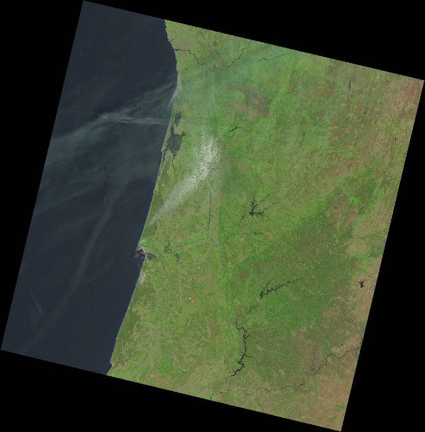
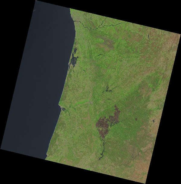
Unfortunately the Iberian peninsula usually suffers every summer more fires than anyone would want, either intentionally or by chance. This year a fatal fire in Pedrogao, Portugal killed more than 60 people. A simple search in Nasa’s Earth Explorer reveal the magnitude of this misfortune.
 Capture from the lesson about how to use the basic algorythms of any GIS (buffers, clips, difference, etc.).
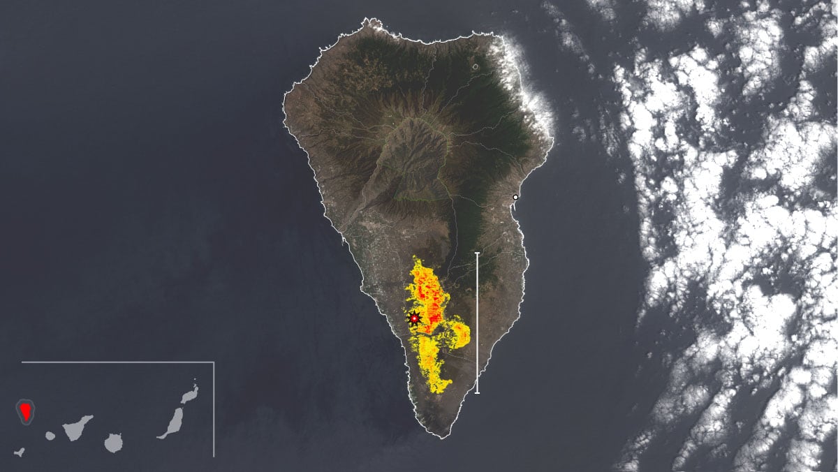
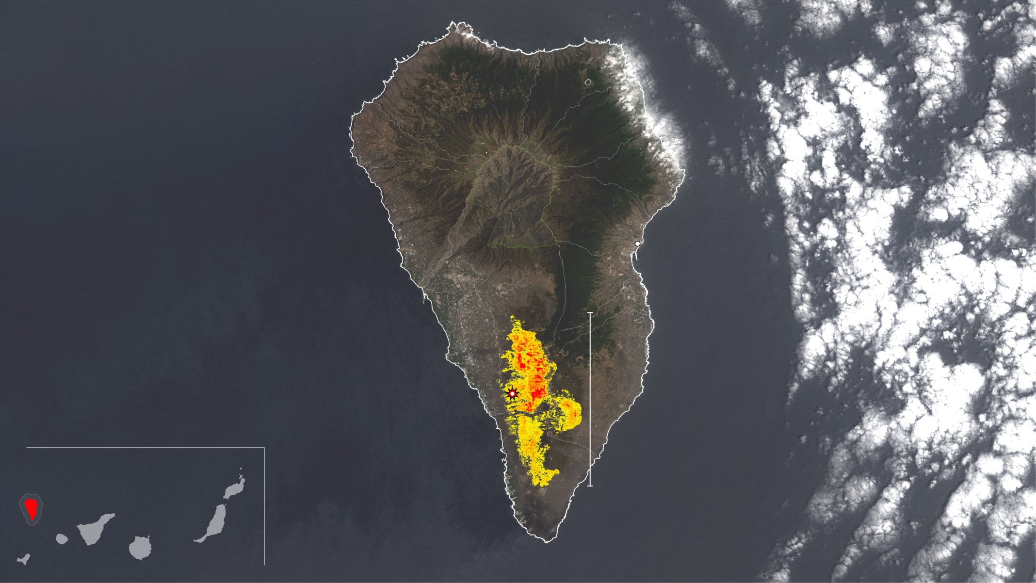
The Landsat 8 sensor allows us to appreciate these consequences on the ground. On the left, a shot taken the 15th of june, on the right the first of july of 2017.
I saw people work with Landsat’s bands and calculate several index to extract information about like NVDI or NBR. I found Nasa’s product guide and this paper from the 2008 International Journal of Remote Sensing write by a spanish investigation group of Cordoba Univeristy.
Thanks to Luca Congedo’s Semi-Automatic Classification Plugin for QGIS is easy to pre processing images, make post processing of classifications or realize raster operations.
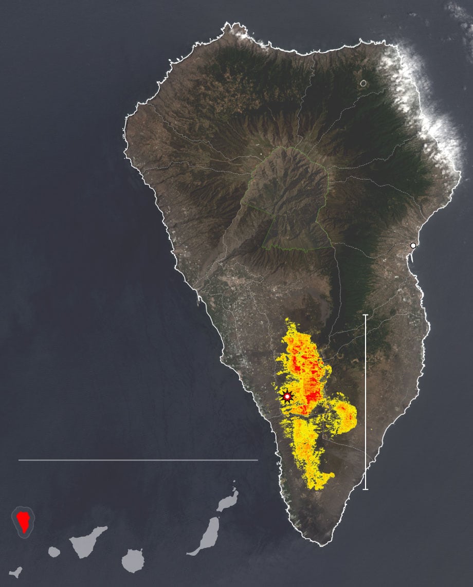
I have had the opportunity to apply my new and humble knowledge twice. In the context of Portugal fire we wrote a feature about how similar is the scenario in Spain. I analyzed the fire occured in La Palma island that burned 7% of its land.
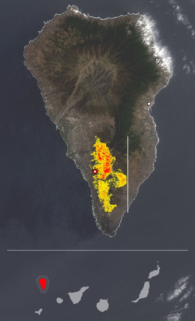
la palma
P. N. de la Caldera
de Taburiente
Sta. Cruz de la Palma
Superficie afectada
por el incendio de 2016
16 km
Foco del incendio
Océano
Atlántico
Canarias
la palma
P. N. de la Caldera
de Taburiente
Océano
Atlántico
Sta. Cruz de la Palma
Superficie afectada
por el incendio de 2016
16 km
Foco del incendio
Canarias
la palma
P. N. de la Caldera
de Taburiente
Sta. Cruz de
la Palma
Océano Atlántico
16 km
Foco del incendio
Canarias
Superficie afectada
por el incendio de 2016

la palma
P. N. de la Caldera
de Taburiente
Sta. Cruz de
la Palma
Océano Atlántico
16 km
Foco del incendio
Canarias
Superficie afectada
por el incendio de 2016
la palma
P. N. de la Caldera
de Taburiente
Sta. Cruz de la Palma
Océano Atlántico
16 km
Foco del incendio
Canarias
Superficie afectada
por el incendio de 2016
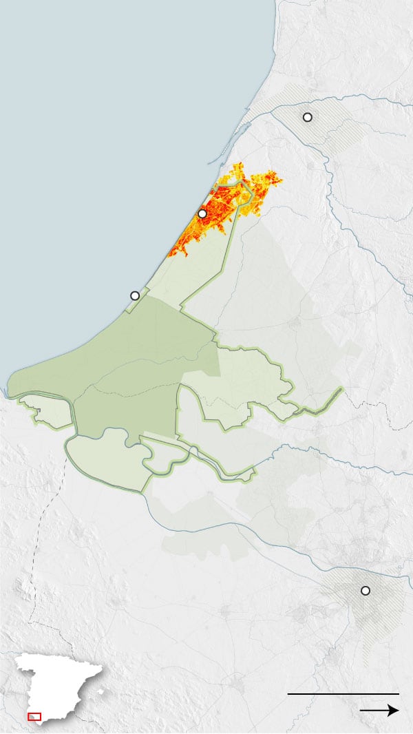
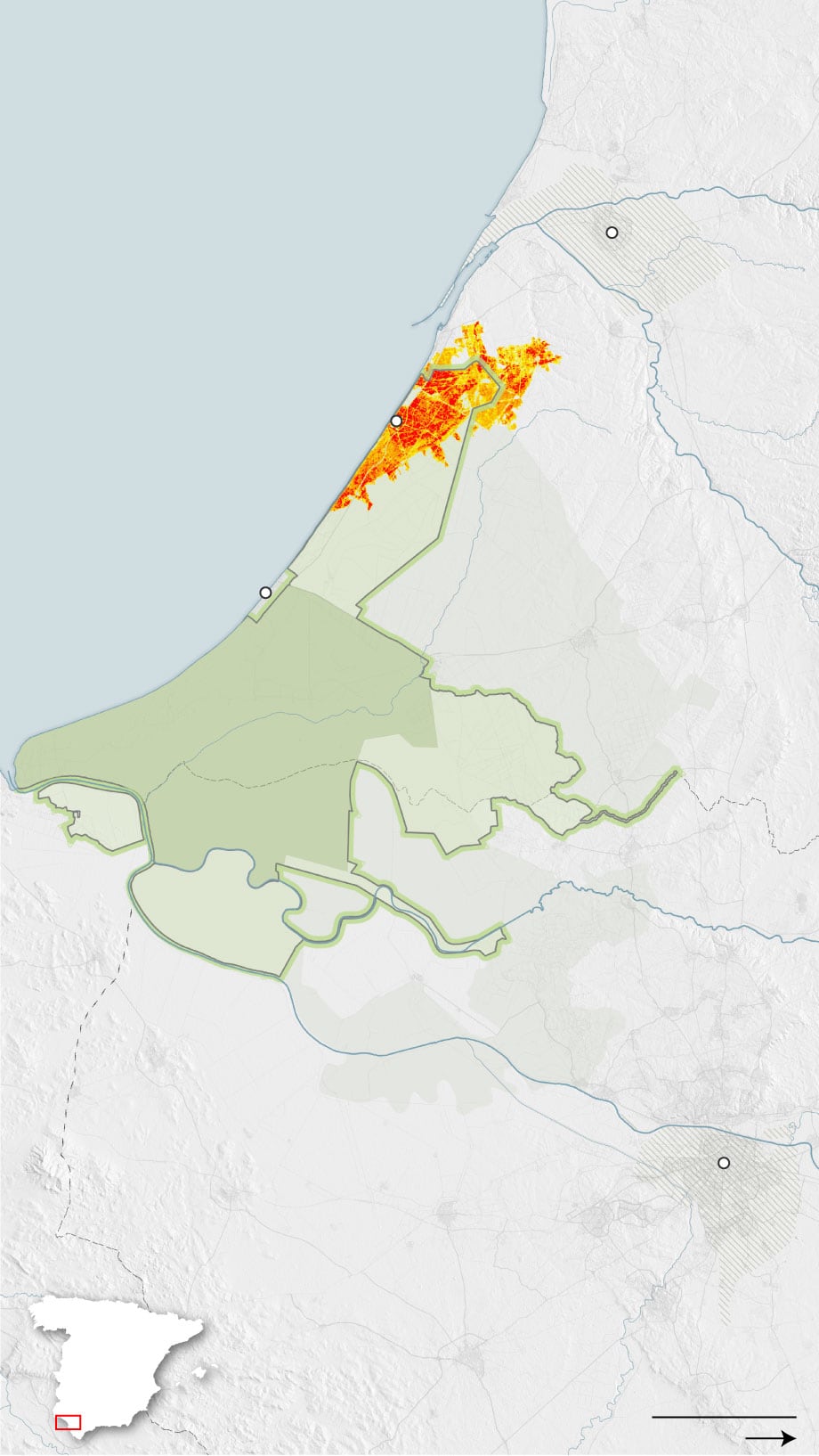
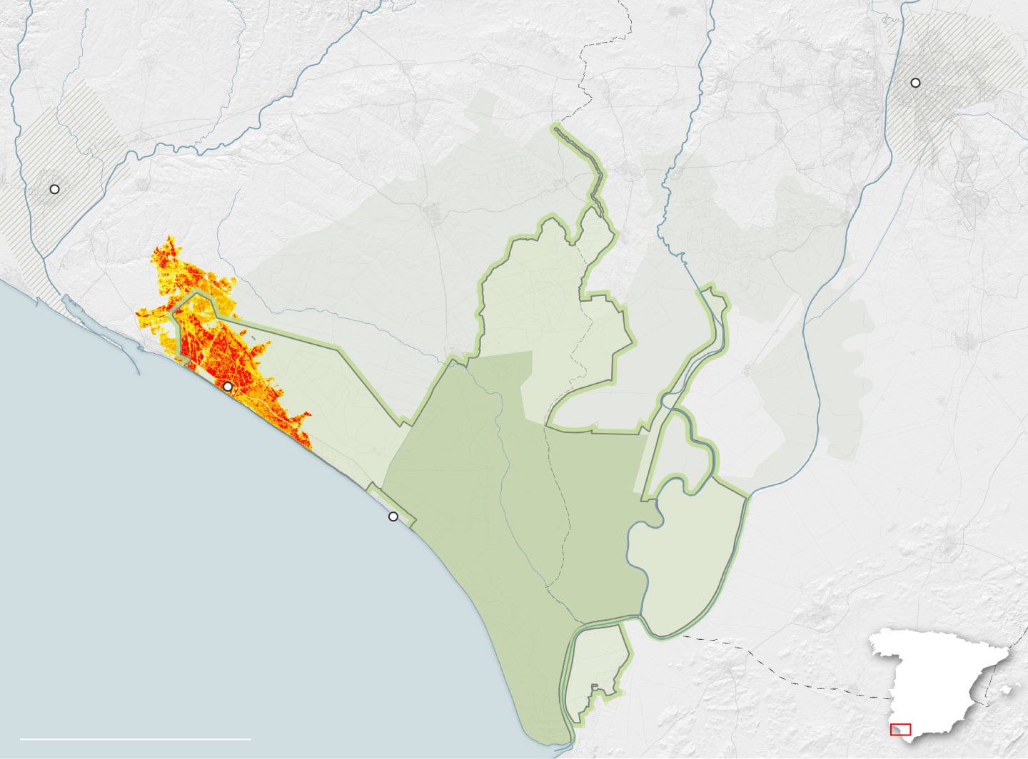
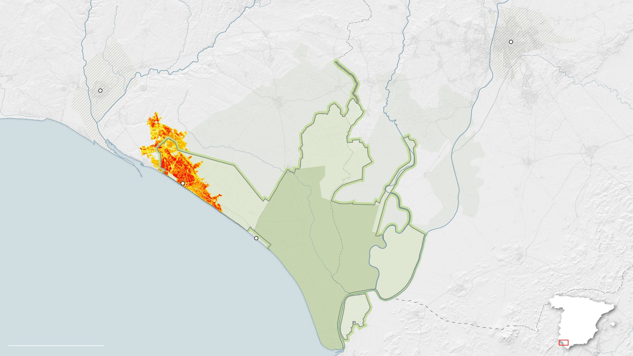
The same weekend that we launch this feature a new devastating fire was declared in Donana’s Natural Park in southwest of Spain. We had to wait until new post-fire data was available to make the comparision and apreciate the fire magnitude.
It was the second chance to calculate the Normalized Burn Ratio (NBR) index from Landsat 8 bands in Donana fire and estimate its magnitude.
Golfo de Cádiz
Municipio de
Huelva
Huelva
Área afectada
por el incendio
Camping Doñana
Río Tinto
Matalascañas
huelva
Parque Nacional
de Doñana
Parque Natural
de Doñana
Río Guadalquivir
Áreas de Influencia
Socioeconómica
Sevilla
Sevilla
Extensión del
municipio de Huelva
Golfo de Cádiz
Huelva
Área afectada
por el incendio
Camping Doñana
Río Tinto
huelva
Matalascañas
Áreas de Influencia
Socioeconómica
Parque Nacional
de Doñana
Parque Natural
de Doñana
Río Guadalquivir
Sevilla
Sevilla
Extensión del
municipio de Sevilla
Río Odiel
Río Tinto
Extensión del
municipio de Sevilla
Extensión del
municipio de Huelva
Sevilla
huelva
Huelva
Río Guadalquivir
Área afectada
por el incendio
Áreas de Influencia
Socioeconómica
Parque Natural
de Doñana
Camping
Doñana
Sevilla
Parque Nacional
de Doñana
Matalascañas
Golfo de Cádiz
cádiz
Extensión del
municipio de Sevilla
Río Odiel
Río Tinto
Extensión del
municipio de Huelva
Sevilla
huelva
Río Guadalquivir
Huelva
Área afectada
por el incendio
Dos Hermanas
Áreas de Influencia
Socioeconómica
Parque Natural
de Doñana
Utrera
Camping
Doñana
Sevilla
Parque Nacional
de Doñana
Matalascañas
Lebrija
Golfo de Cádiz
cádiz