A Custom Dixit Game
This month I had the opportunity of collaborate in a wonderful project, a custom Dixit game as a wedding gift for one of my best friends.
Each of the people who participated in it would make as many cards as he wanted. Some of them handmade that would then be scanned and others digital.
As the wedding will be in A Illa de Arousa, a really nice site in the estuary of Villa García de Aousa (Pontevedra, Galicia), I decided to create a fictional map of the island as if it were an old ancient map that marked the place where a treasure is hidden, in this case the place where the wedding would be. I am not a professional cartographer, much less but I really enjoyed doing this project.
I use GDAL to create the shaded relief. QGIS to create the base map with OSM data (buildings, roads) and the composition. Then I use Photoshop for the effects and Illustrator to create some paths.
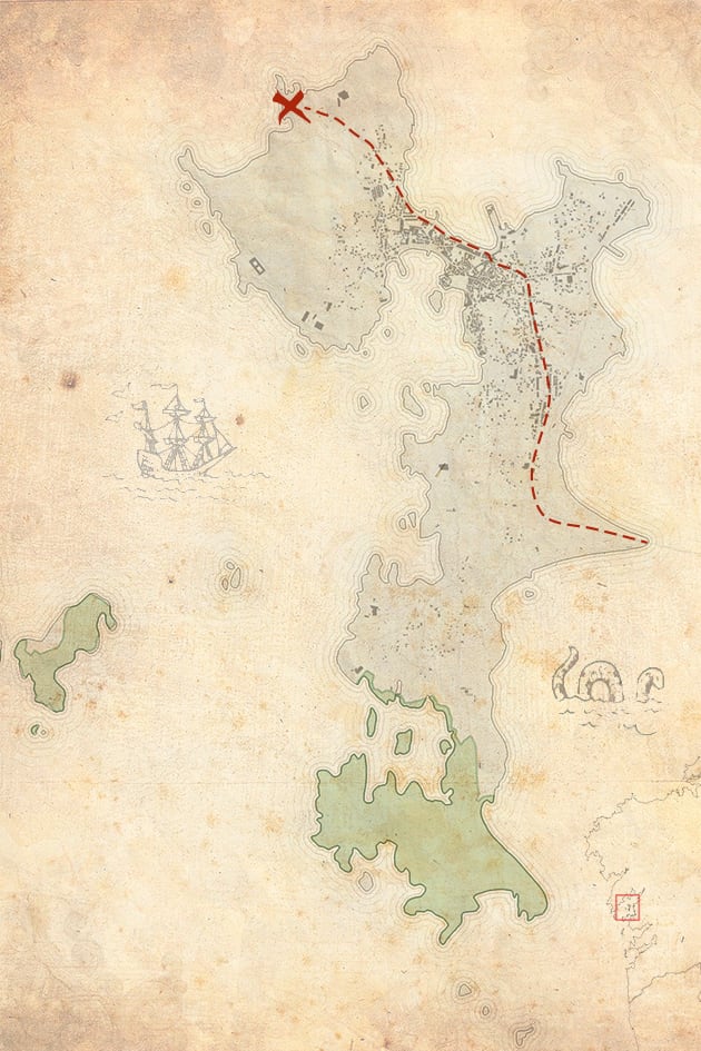 I am not a great illustrator so I was inspired by an old map to create the ship and the sea creature.
A few weeks ago I was on the island and was surprised by its orography. This has a huge bridge that was built in the eighties. When I returned I was looking at old aerial images to see how the evolution of the place had been. I make this gif:
 Data from the Fototeca of CNIG (https://fototeca.cnig.es/).